Visual Hierarchy
The concept of visual hierarchy, also called ‘figure-ground phenomenon’ or ‘visual level' pertains to the ‘perceptual organisation’ of the map. It enables the map reader to perceive a difference between the information that compose the foreground (figure) and the information in the background (ground).
Part 1 – Ground Assignment
The visual level of each layers is determined using information provided by the user and by the geoportal regarding the map and the layers: layer geometries, layer themes and categories, map type and main layers of the map.
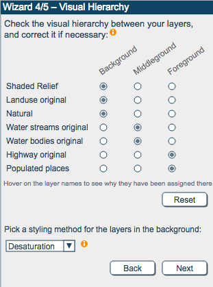
The function assigns the layers to the different grounds based on the information the user provided before and the type of layers and map type selected. First, some general rules are applied to assign layers to background and foreground. Then, based on the chosen map type, additional specific rules are used.
General rules:
- All main layers are assigned to the foreground.
- Raster and ready-to-use maps are then assigned to the background.
- Polygon layers that are not water-themed nor main layers are assigned to the background
- The rest of the layers are assigned to the middle ground.
Specific rules:
- In thematic maps , thematic layers are assigned to the foreground.
- In political maps, administrative layers are assigned to the foreground.
Part 2 – Background Symbolization
The second part of the function can change the symbolization of the background layer(s) to render them less prominent and thus support a better visual hierarchy within the map.
Grayscale (luminance)
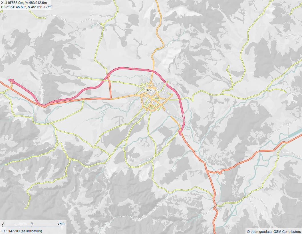
Grayscale formulae
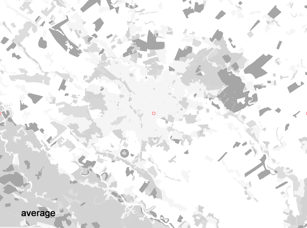
"Average" method: gray = (R + G + B)/3
"Desaturation" method: gray = [Max(R,G,B) + Min(R,G,B)]/2
"Luminance" method: gray = R*0.3 + G*0.59 * B*0.11
Desaturation
Smart Background